These photographs are being displayed to bring about the remembrance of the almost 60-year history of this road and the park that was created after the Ga DOT was stopped from putting in the Jimmy Carter Presidential Parkway. The history is of how the neighborhoods fought the state of GA DOT twice to stop the road and finally compromised a limited access road that did not cut through 3 city parks, dividing neighborhoods to create this Art Park, Freedom Park.
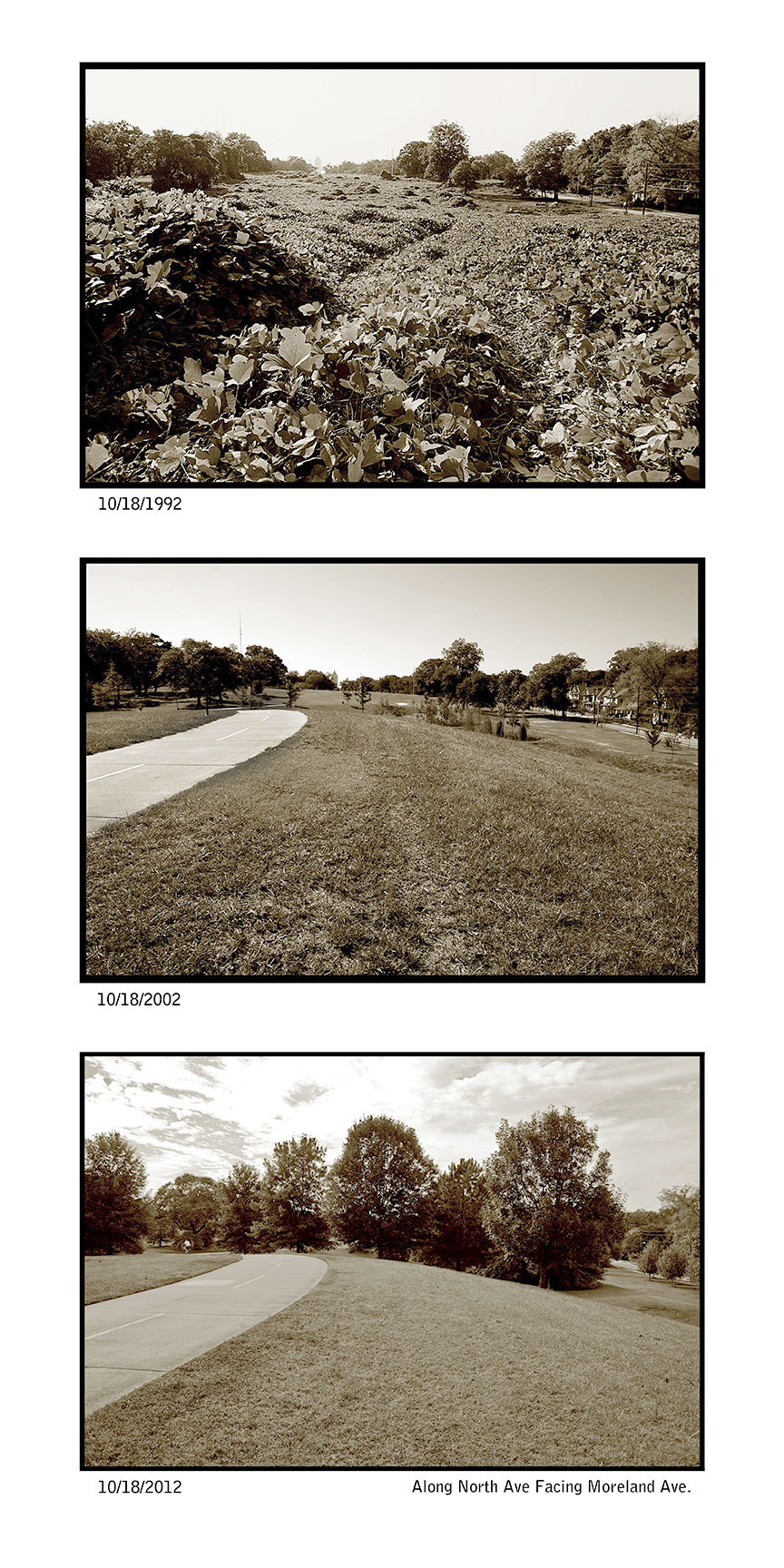
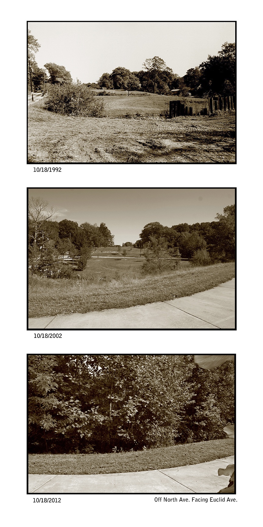
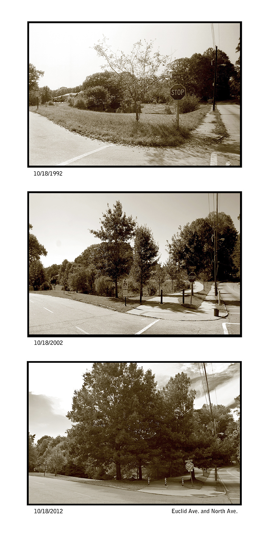
Decades is Part 2 from the series Decade commissioned by Don Bender to show the sites before the construction began for Freedom Park as shown on the Decade: 1992 & 2002 page on this site. The sites were chosen, because of the visual or interest I had for the site. I photographed the whole park through construction and during events such as Art in Freedom Park and Naked Freedom.
Nine intown neighbors joined forces in the 1970s to fight an expressway that would have destroyed historic intown neighborhoods. A four-lane expressway with 5 bridges over neighborhood streets was planned for construction by the Georgia DOT, through the 219 acres we now know as Freedom Park. In the face of such formidable opposition, the neighborhoods sustained years of legal action in courts all the way to the Georgia Supreme Court. It was a 20-year battle waged by resident volunteers. Rep. John Lewis was on the Atlanta City Council at this time and he and many others including Mayor Maynard Jackson joined in the fight with neighbors.
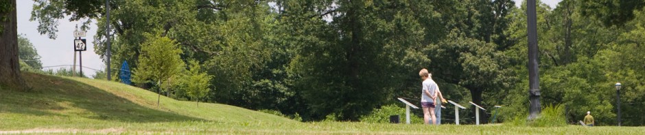
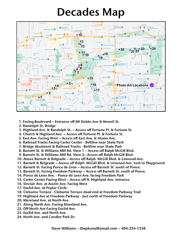
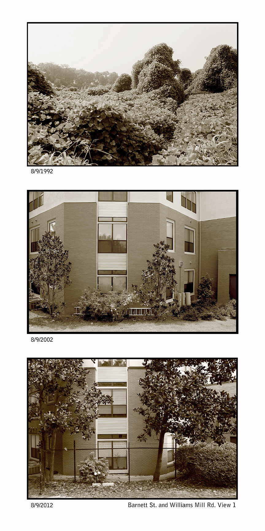
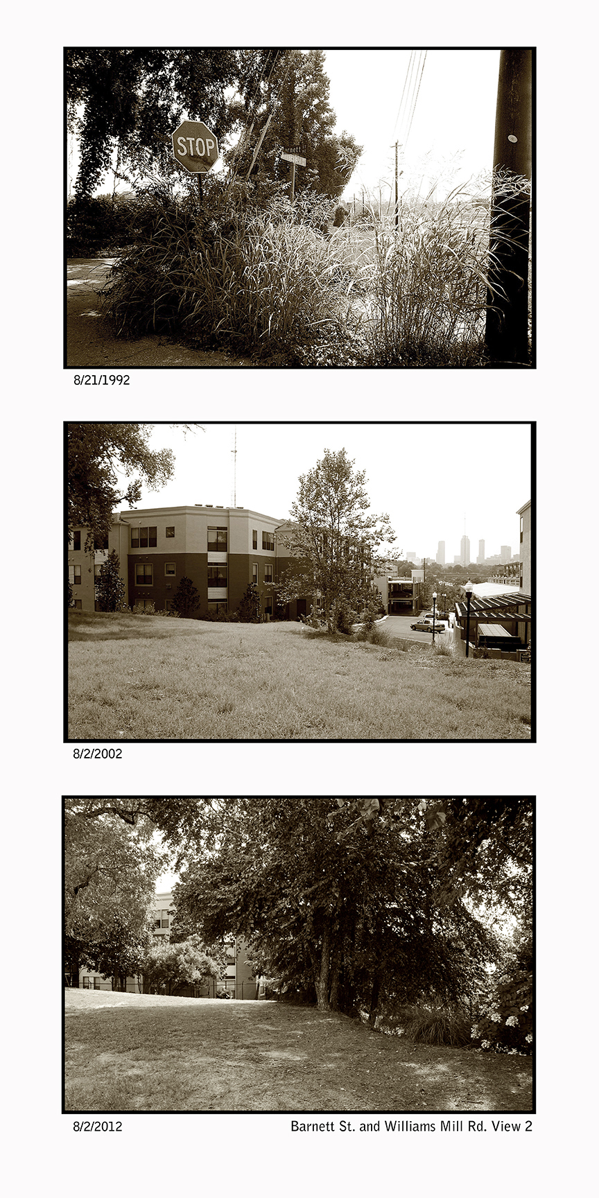
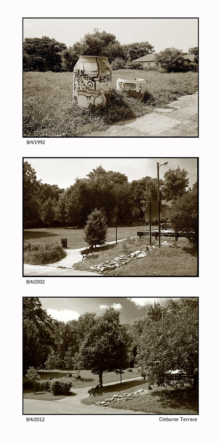
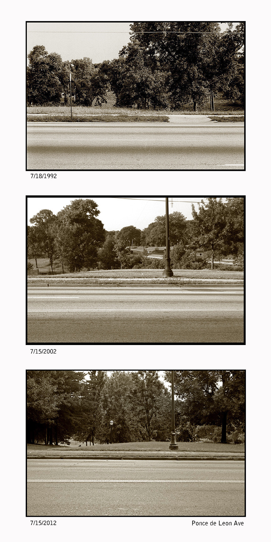
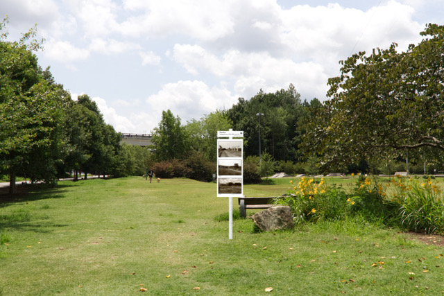
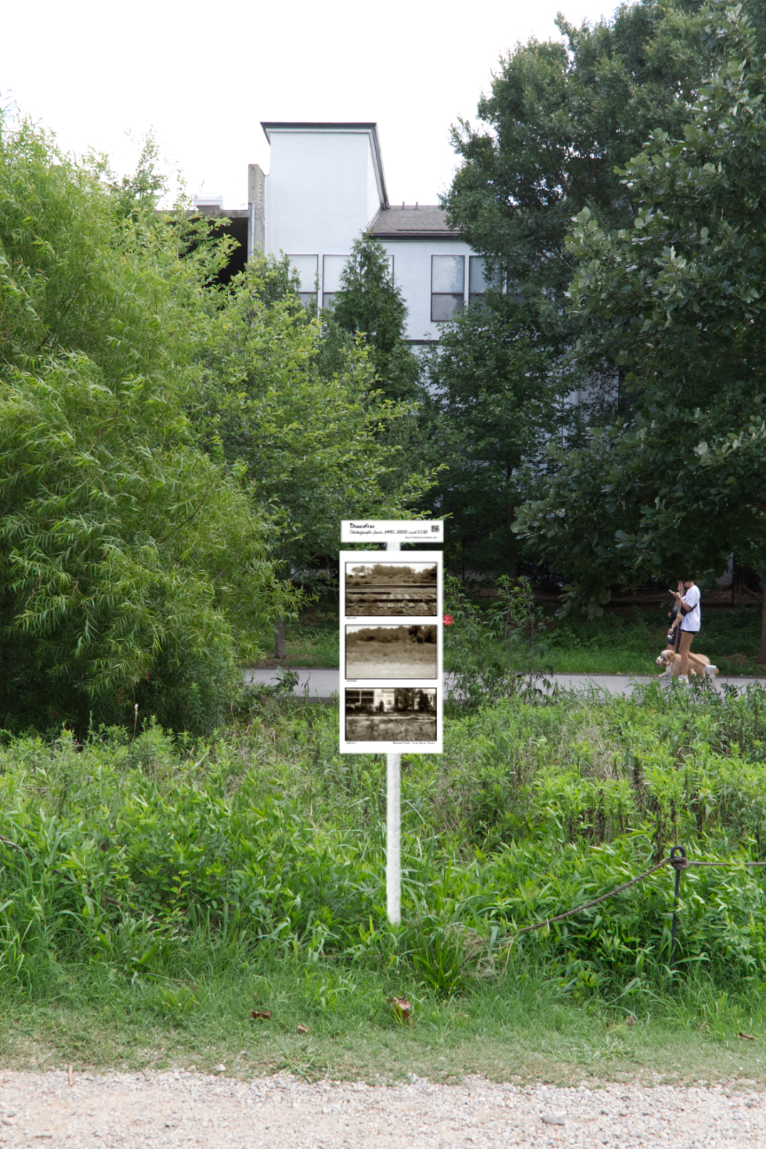
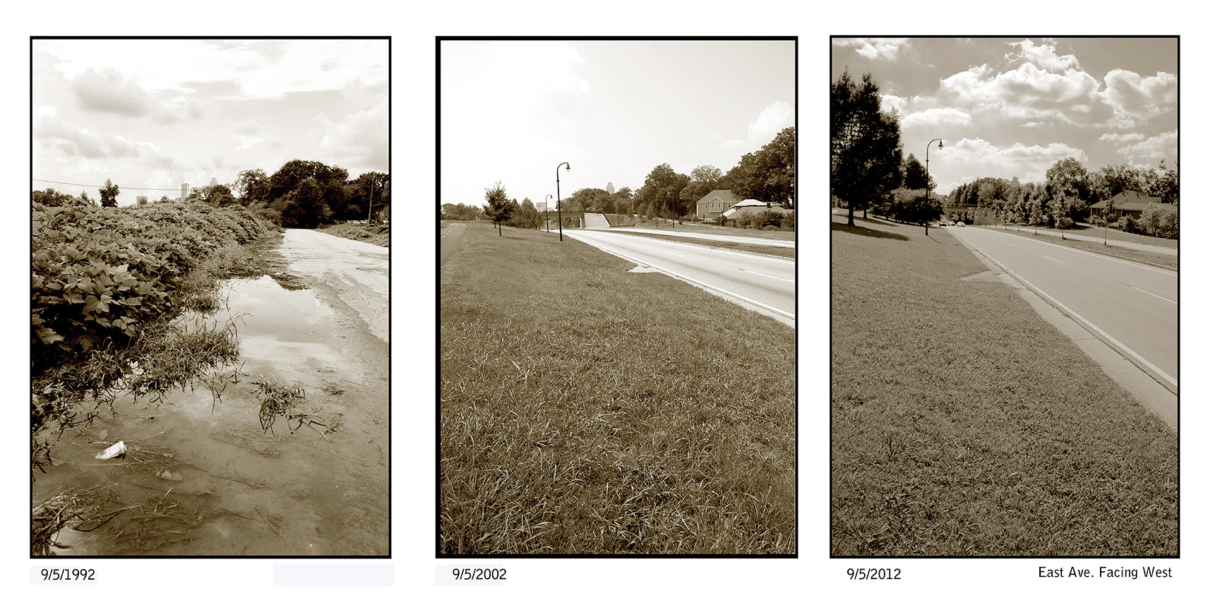
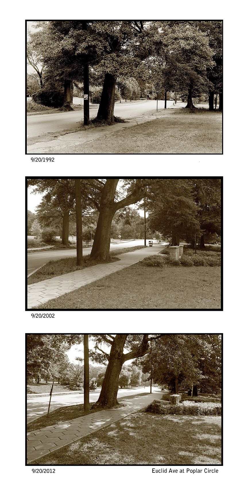
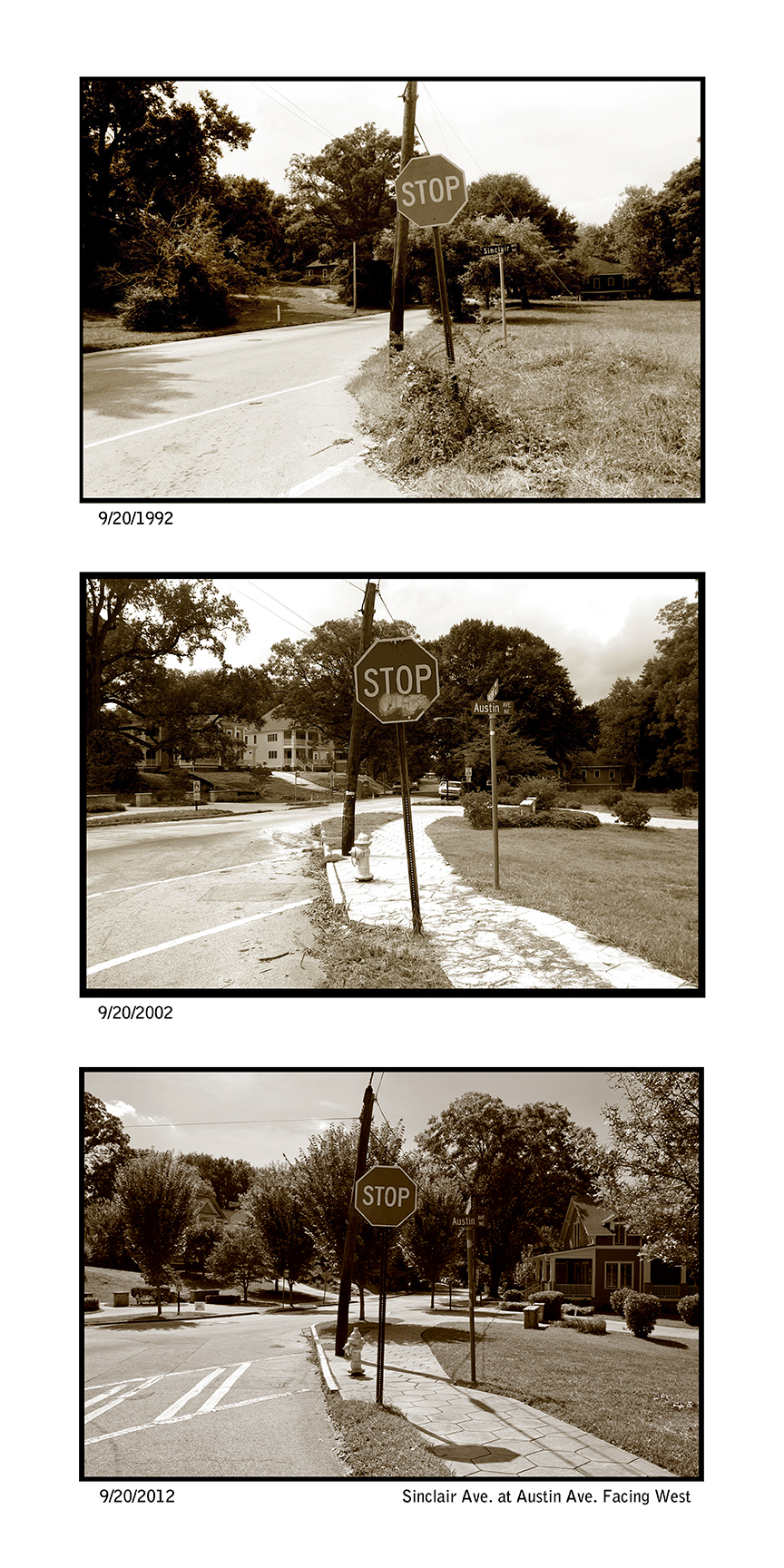
This series below shows the same location in 1992, 2002 and 2012 allowing the visitor to see it 10 years later near or at the site of the anniversary of the photo. I am hoping at each location time will be taken to look around and appreciate what this land has become and the tumultuous history to get there. These photographs are on display throughout Freedom Park at the site they were taken to show the changes in the land as it has developed over the past 30 years. They were placed on site starting 10/1/22 in conjunction with Atlanta Celebrated Photography. Locations are on the map to download linked here. If you are having trouble finding the site scroll down to the photo and read the caption. There are also stories of some of the sites.
I hope this series will allow the public to explore the park and appreciate the history and the benefit it ads to the communities that surround it.
If groups are interested please contact me to set up a tour.
Thanks to Colorchrome for the prints
Thanks to Oscar of Gonzalez Construction for art installation. Specializing in Decks, Waterfalls, chimneys, driveways, patios landscaping and more… 404-707-8713
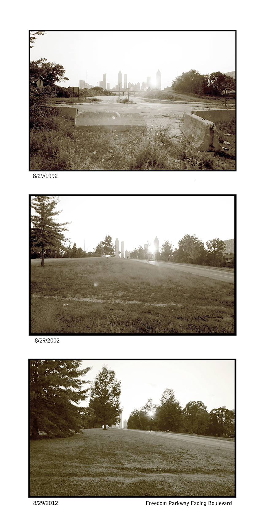
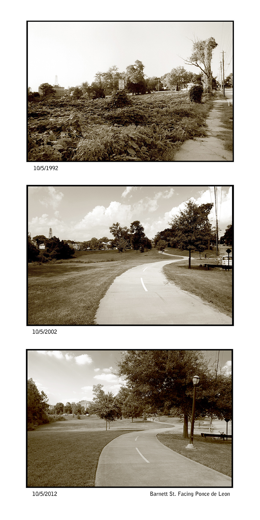
This the entrance to Freedom Park from the west where the road originally ended on Howell St. as the trail in the other two photos show. The photo was taken in between the two lanes, however I placed the triptych where the observer would be safe. The Boulevard bridge is buried now.
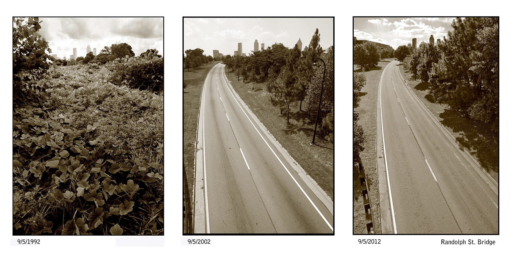
The place to view this triptych site is by the orange spot on the rail. Notice the closeness of the kudzu.
The first photo shows a trail probably made by one of the several homeless vets that occupied the current park as the land waited to be developed.
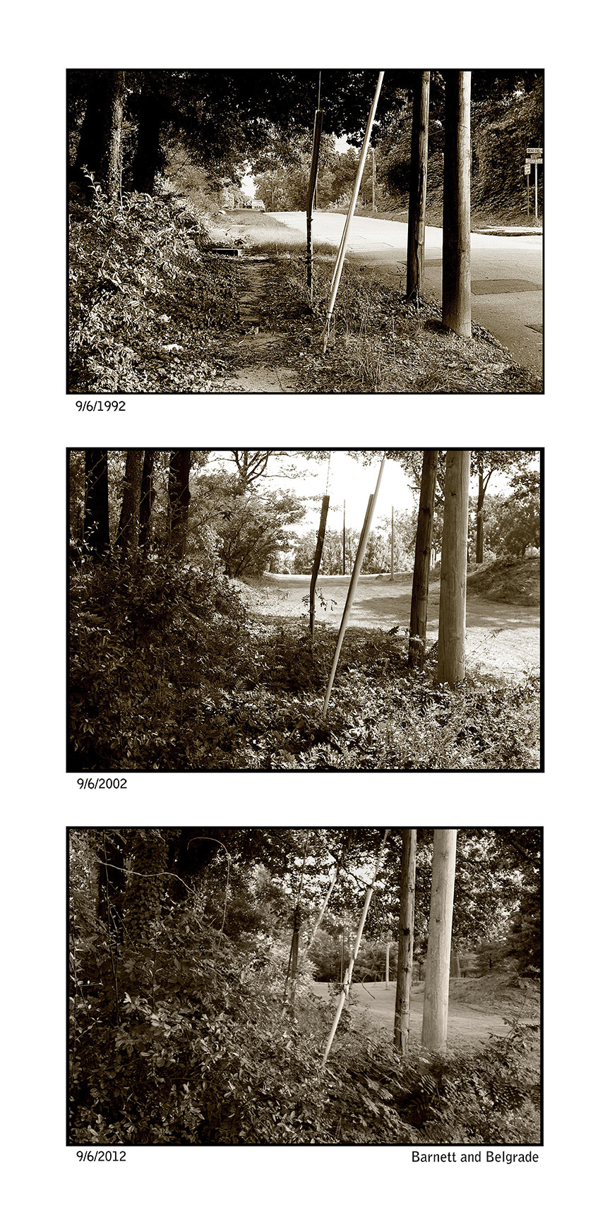
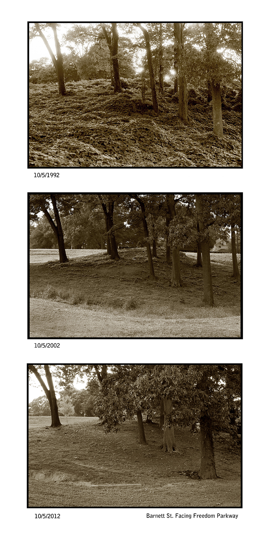
The remnants of the Barnett St. and Belgrade Ave are still intact. However, the houses are gone.
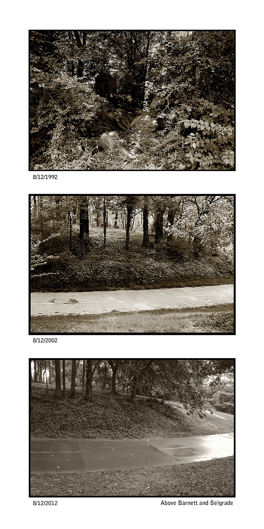
This site was where another homeless vet once lived.
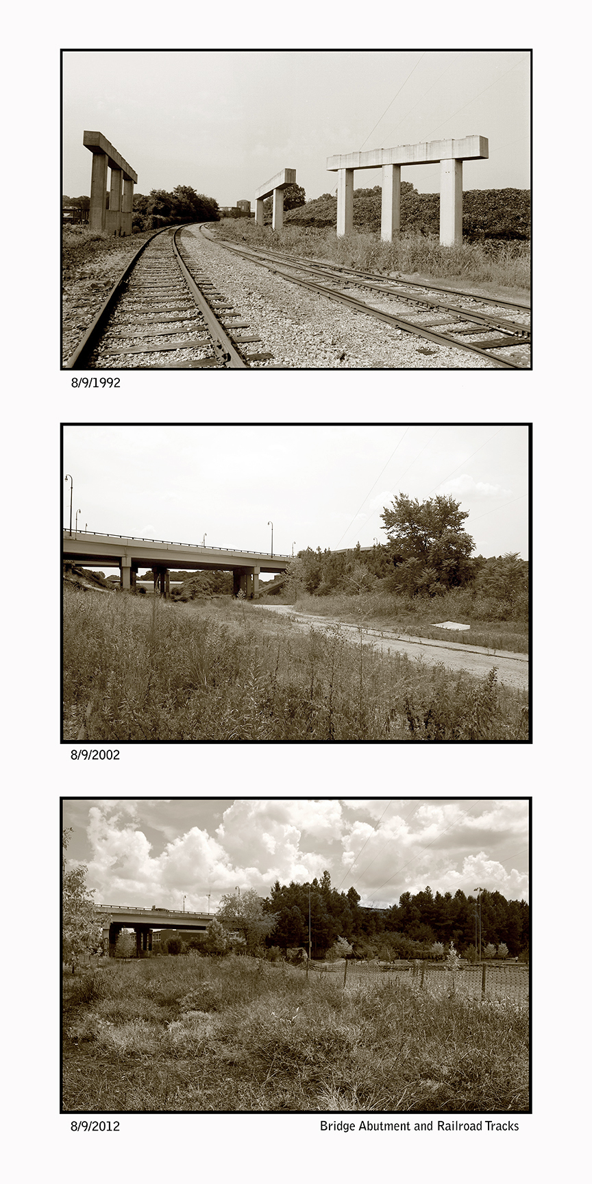
The first photo shows the bridge abutments placed by the GA DOT for the Presidential Parkway that was later scrapped.
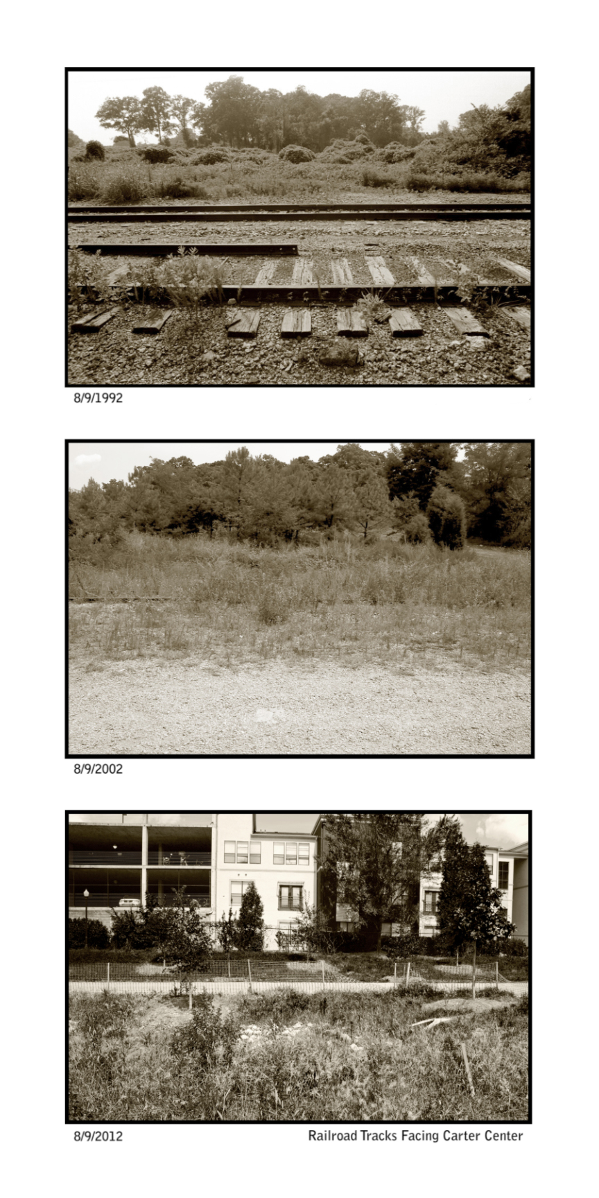
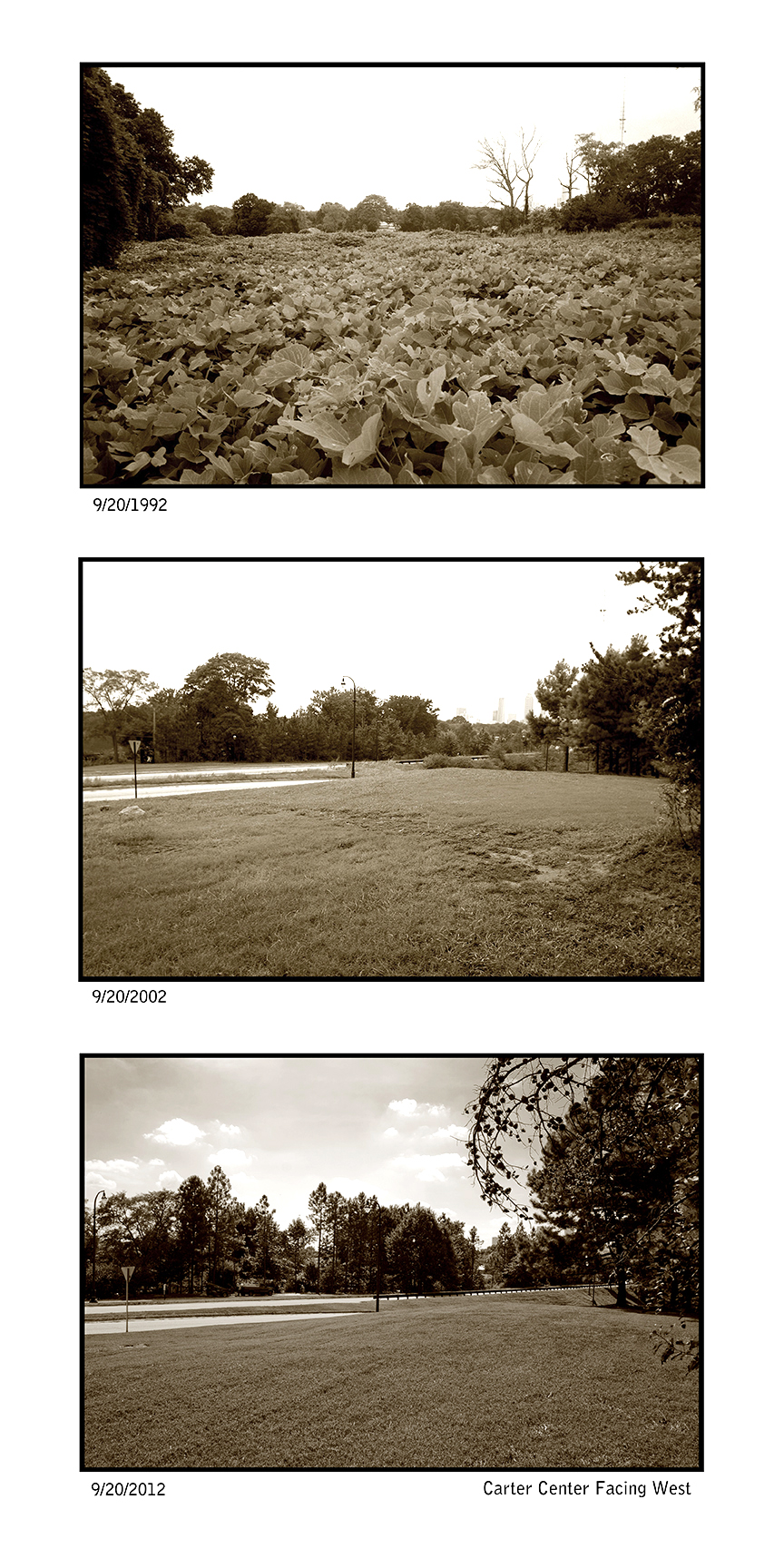
The trees in the background of the first photo show where the Carter Center was to be built.
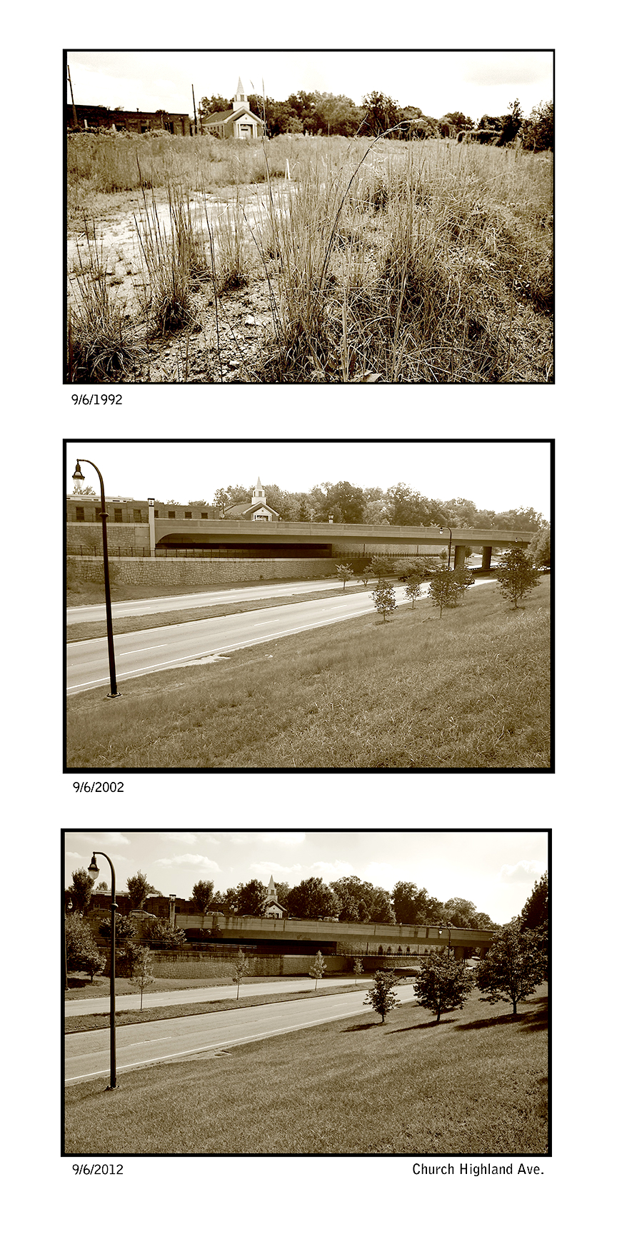
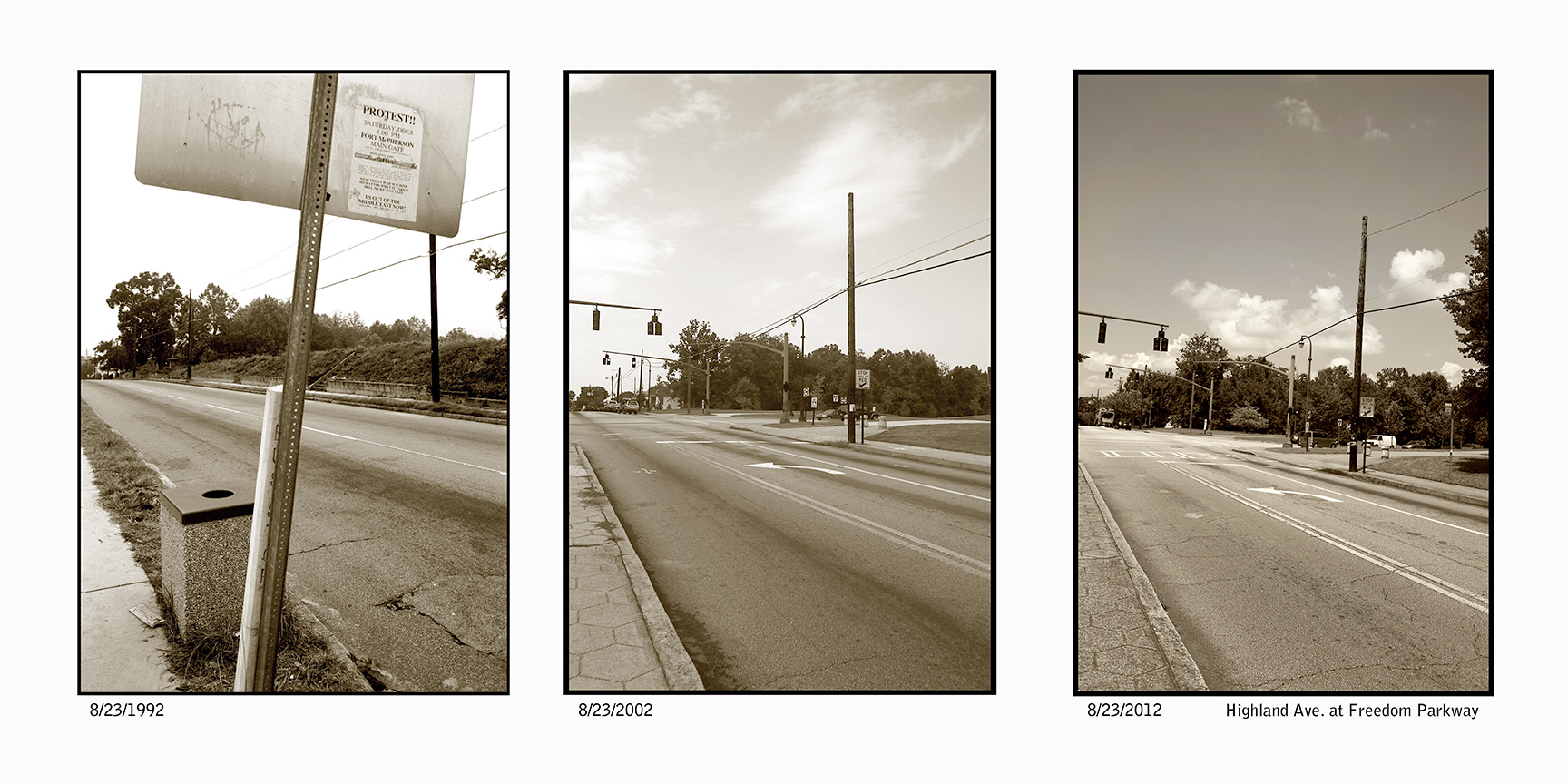
This site is just north of the intersection of Freedom Parkway and Highland Eve. The triptych is on the other side of the sidewalk, but the view is from the tree with the broken branch near the curb.
Notice the steps across the street where hundreds of people were displaced in the 1970’s by “The Road”. If you continue south on N. Highland there are more steps on the right as honored by Karen Tauches in her performance piece Disappeared Houses during the Art in Freedom Park in 2005.
If you get there mid afternoon you may see the bike rider relaxing in a hammock across the parkway in the woods. The tree to the right in the last photo shows where. I often see unique occurrences in Freedom Park.
Notice my van in the second photo.
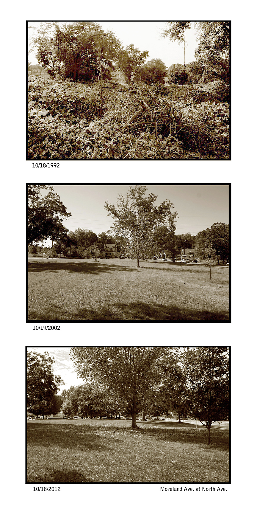
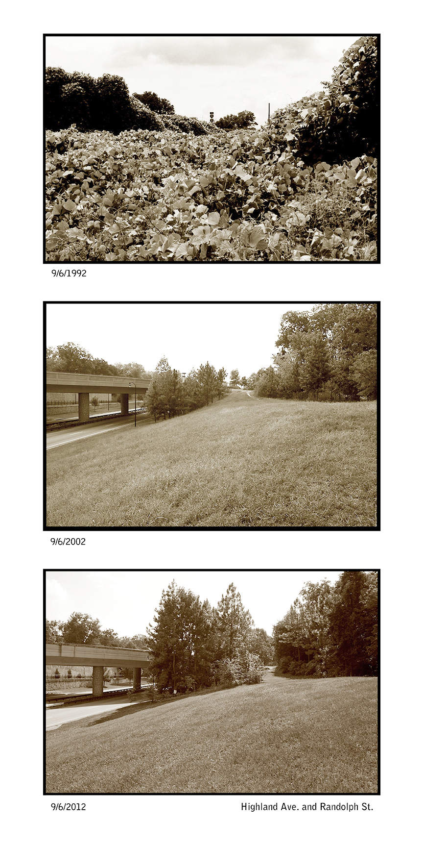
Notice how big the trees have grown!
In the top photo are the remnants of the Presidential Parkway road. I wish they had been kept to remember the struggle. This is also a part of Goldsboro Park, one of three city parks which the DOT was going to build a road through a park that is not allowed by code.
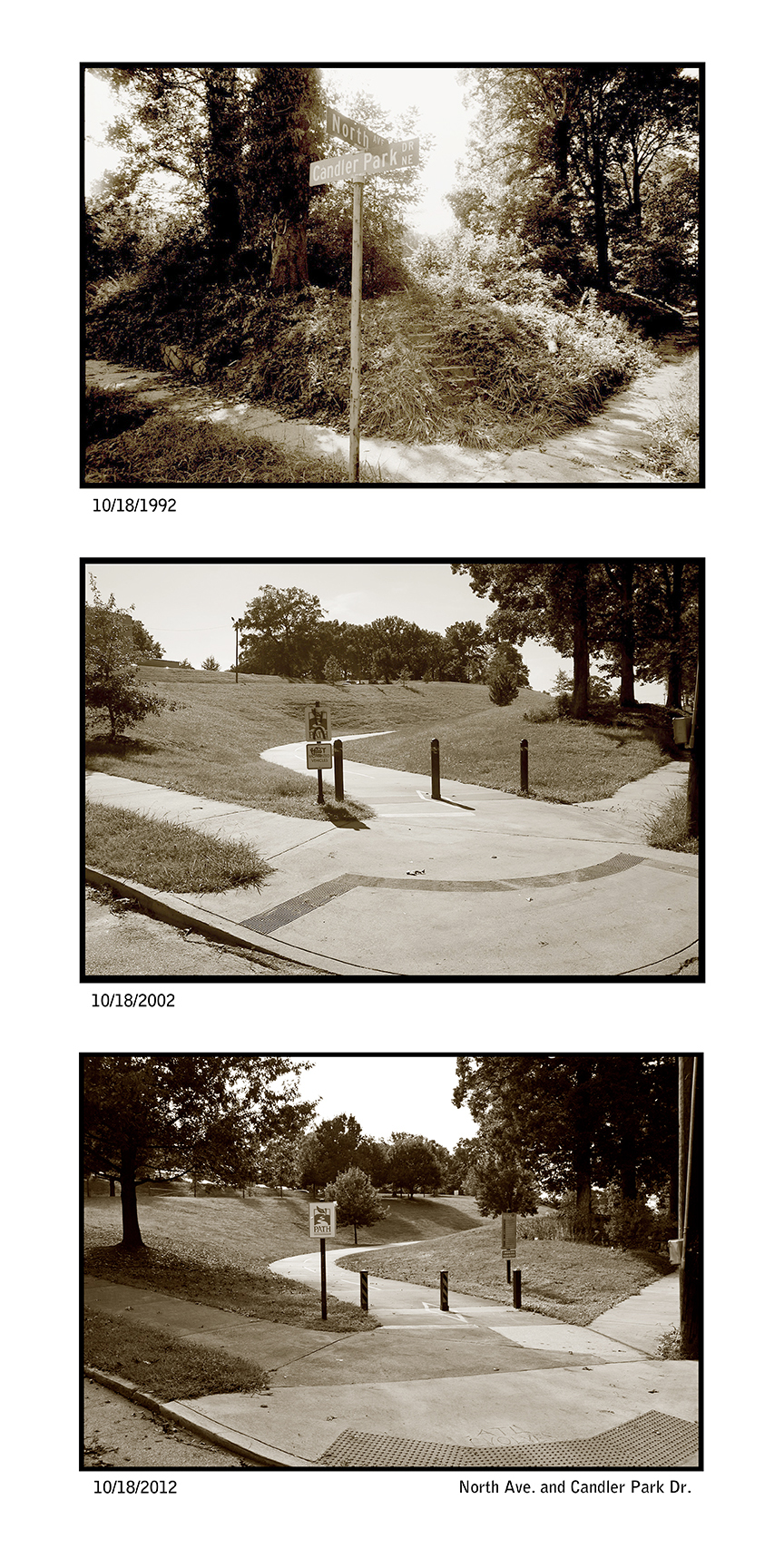
Notice the stairs again. There are still driveway cuts still on North Ave between Candler Park Dr. and Oakdale Rd.